São Paulo, Brazil
2013-2017
São Paulo Urbanismo team
ABOUT
ABOUT
ABOUT
GABRIELA CALLEJAS
METROPOLITAN CENTRALITY
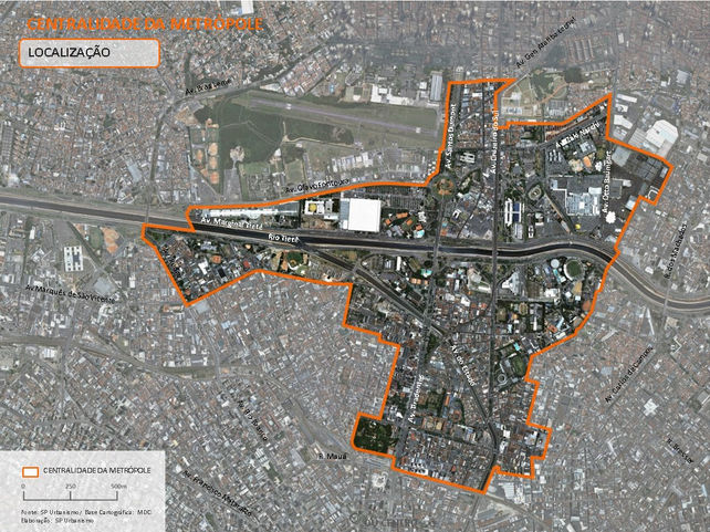
Metropolitan Centrality (Centralidade da Metrópole) is one of the three Urban Intervention Areas (Áreas de Intervenção Urbana – AIU) defined in the Arco Tietê Urban Plan. It addresses the consolidation of a centrality at a metropolitan scale, in a 655ha-site located at the mouth of Tamanduateí River and structured along the historic north-south axis that connects the North Zone of the city with downtown São Paulo.
where_
when_
who_
São Paulo, Brazil
2015-2017
São Paulo Urbanismo team, Gabriela Callejas (coordinator)

The project aims at restoring the contact with both rivers – Tietê and Tamanduateí - lost decades ago after the construction of drainage and road infrastructure. This would be achieved through a set of specific actions:
-
implementing a linear park along the Carandiru stream;
-
transforming Tamanduateí axis, changing road geometries and creating open spaces, continuing the strategies defined on Bairros do Tamanduateí Urban Operation - OUCBT;
-
and creating a public park at the mouth of Tamanduateí, while articulating an open spaces network along Tietê´s margins, which would benefit from the existing public and underused properties available in the area.
Therefore, this system will incorporate or integrate into existing parks and plazas – such as the Youth Park, Tietê Sports Center, Baseball Stadium, Extreme Sports Park, Parque da Luz and Armenia - and the mobility infrastructure. These connections will take place through boulevards and green streets, responding to environmental demands and adding great aesthetics value to the plan.
The plan also takes into consideration increasing population and jobs densities along the north-south axis (Tiradentes-Santos Dumont and Cruzeiro do Sul Avenues) , with higher Floor Area Ratios and incentives for mixed uses. Besides that, it creates specific development sites on public and private underutilized properties, setting requirements for producing social housing and public services.
The AIU model defines that resources captured through selling additional FAR rights to developers would finance a set of public works defined on the plan, such as the public open spaces, new roads infrastructure and changes in geometry of the existing network to provide better access for foot, bicycle and public transit users. In addition, new bridges over Tietê and Tamanduateí rivers help connect neighborhoods that otherwise would be fragmented and poorly connected.
Please note that all the content belongs to Prefeitura Municipal de São Paulo. For more information, visit https://gestaourbana.prefeitura.sp.gov.br/estruturacao-territorial/arcos/arco-tiete/


